We have developed a unique SeeUnderSea methodology that enables precise mapping, measurement, and monitoring of underwater infrastructure. Everything that was once hidden beneath the sea is now revealed.


Digital twin
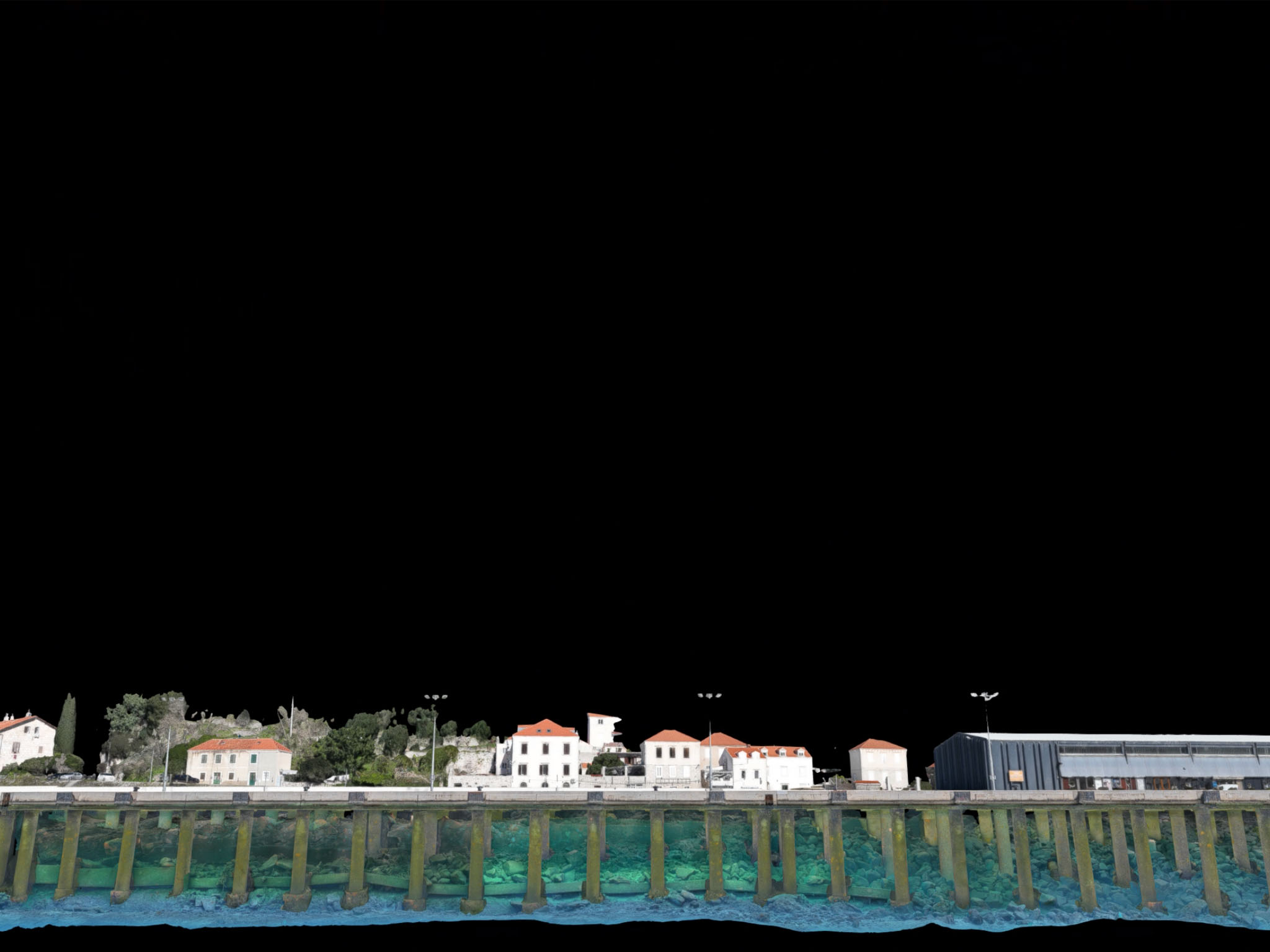
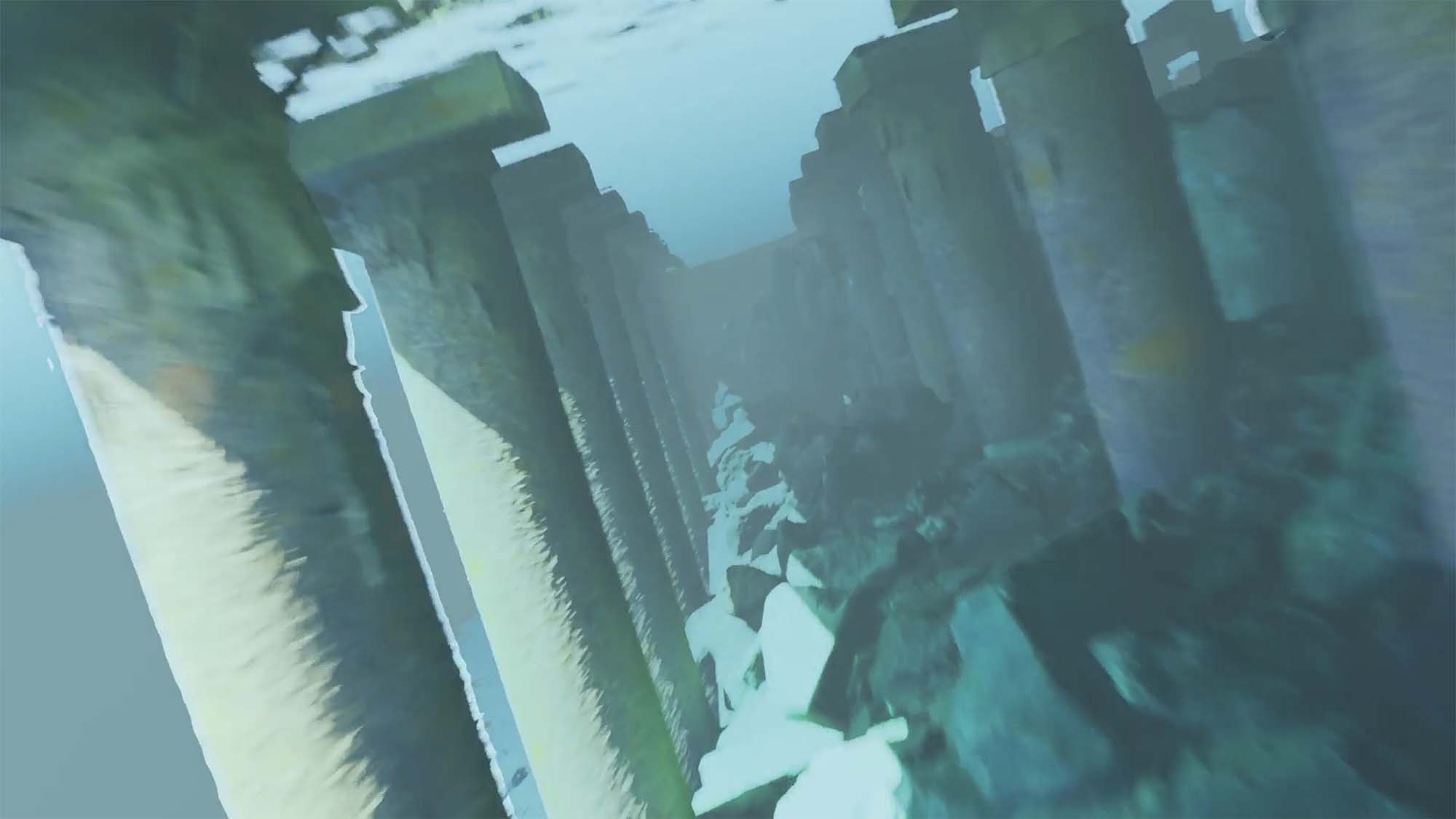
Digital twin of underwater infrastructure
A digital twin of underwater infrastructure is a georeferenced, photogrammetry-based digital record of the actual condition of a structure. It enables monitoring, crack and degradation detection, and analysis of changes across large areas. The data is integrated into a unified digital environment where it relates to other relevant information, such as sea level, weather conditions, vessel movement, dimensions, and route planning.
This transforms the model into an operational tool for analysis, simulation, and decision-making in a real-world context, with the possibility of real-time data integration.
This transforms the model into an operational tool for analysis, simulation, and decision-making in a real-world context, with the possibility of real-time data integration.